Lawsuit Filed

Protecting Our Intellectual Property

Many Engrain clients and partners have inquired about the details of the infringement and status of the case, and based on Beans continuing to serve Engrain maps from their servers and on live web pages, we have decided to share more details.

We have found 1000s of instances of copied map designs.

Engrain has filed a copyright infringement lawsuit against Beans for the unauthorized use of our copyrighted interactive property map data. Unfortunately, the infringement has not stopped. In fact, not only is Beans continuing to serve Engrain maps from their servers and on live web pages, they are willfully propagating the infringement through partners.

What Happened

Engrain invests significant resources in designing detailed community maps through our SightMap product. Beans, a competitor, was discovered serving map data through their WebWidget product that is strikingly similar to — and in many cases indistinguishable from — Engrain's copyrighted designs.

Engrain's SightMap

SightMap is Engrain's interactive property map platform. Each property map is carefully crafted using proprietary processes, representing a substantial investment of time, skill, and resources. These maps are protected by copyright as original creative works.

Beans' WebWidget

Beans offers a competing interactive map product called WebWidget, which is embedded on property websites in a similar manner to SightMap. Our investigation revealed that Beans' map data — the polygon shapes, coordinates, and spatial relationships that define each property — bears an unmistakable resemblance to Engrain's copyrighted data.

How Are Unit Maps Designed?

Unit Maps are digitally designed representations of apartment and building shapes. The placement, spacing, detail, and proportion of these shapes are designed under the careful judgment of trained designers who must interpret a wide-ranging body of source material.

The source material is provided by our clients, multifamily operators and managers, as part of the paid onboarding process. Reference material ranges widely from very basic hand-drawn crude representations of properties, to inaccurate and stylized marketing maps, to extremely complex architect plans that require significant interpretation and streamlining.
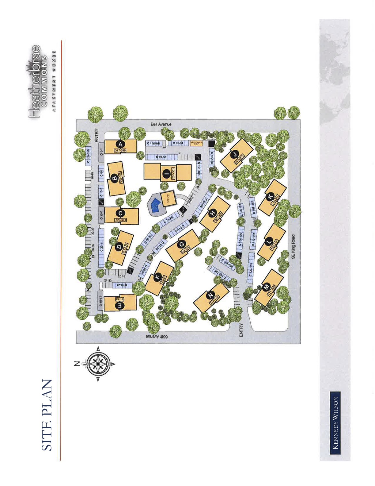
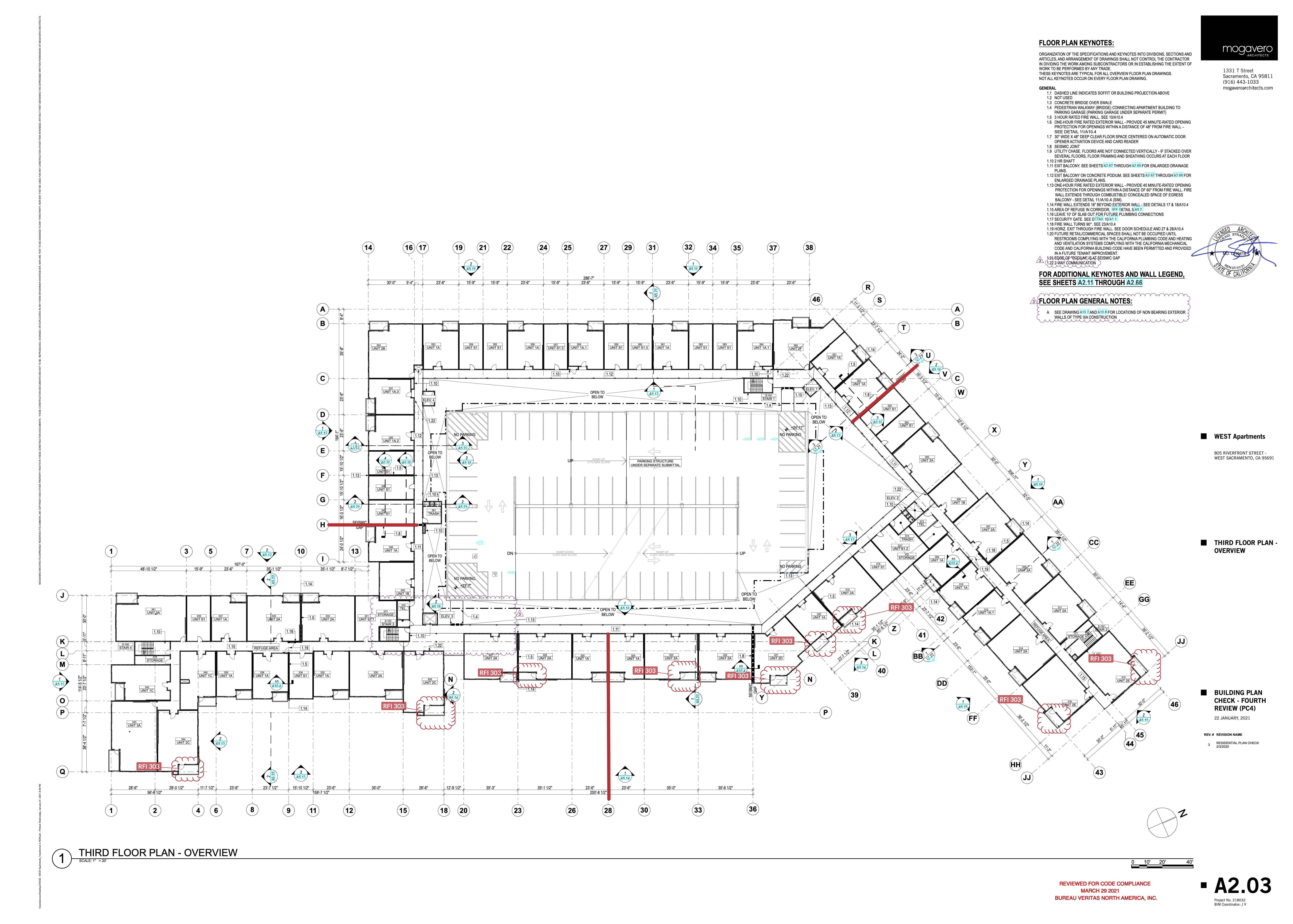
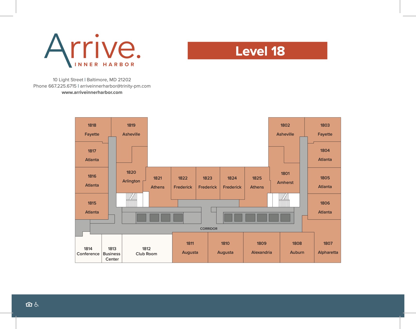
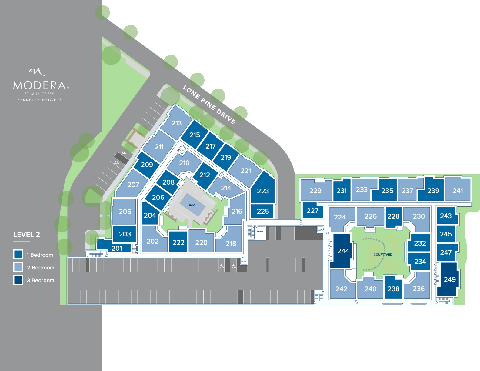
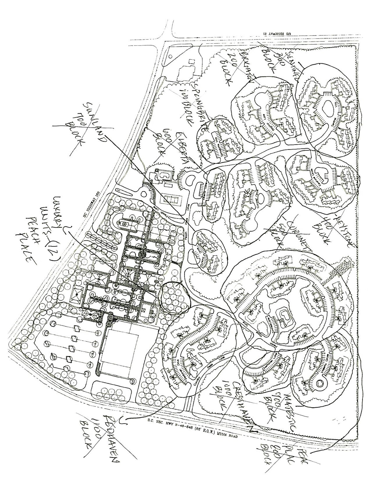
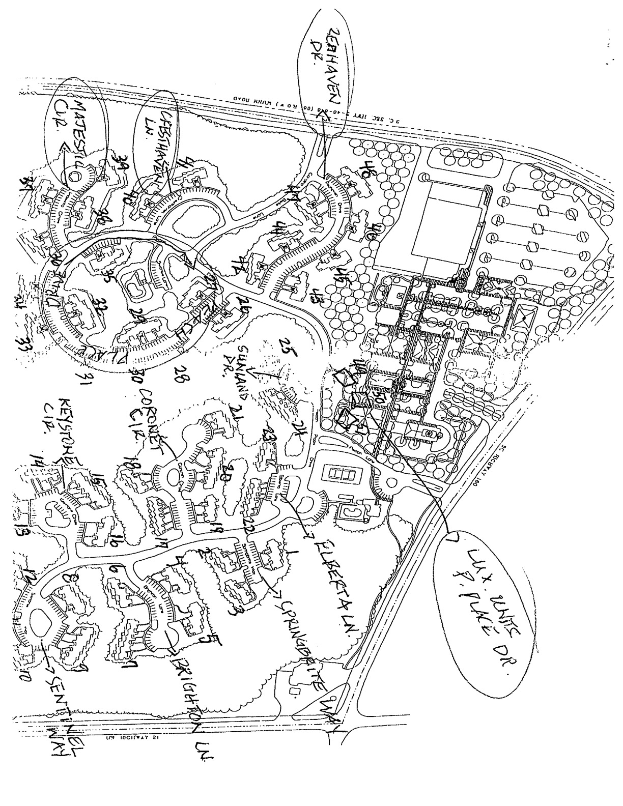
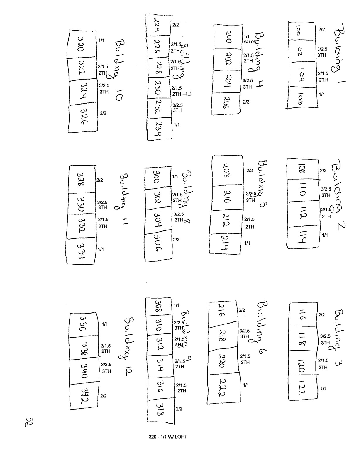
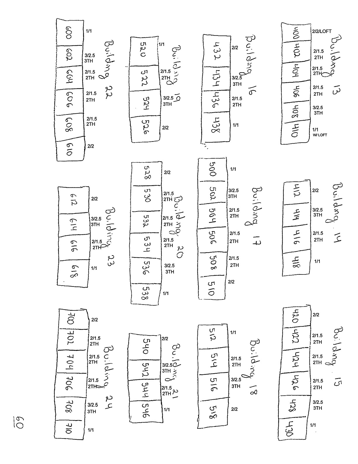
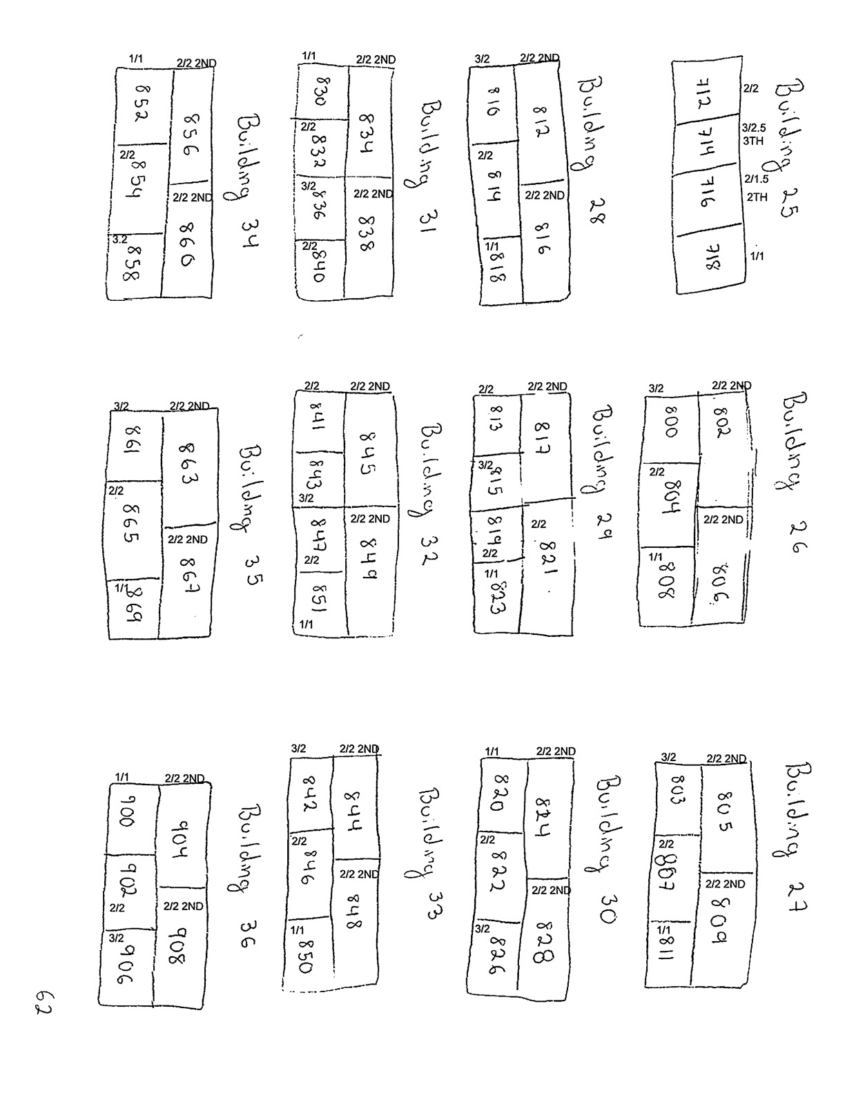
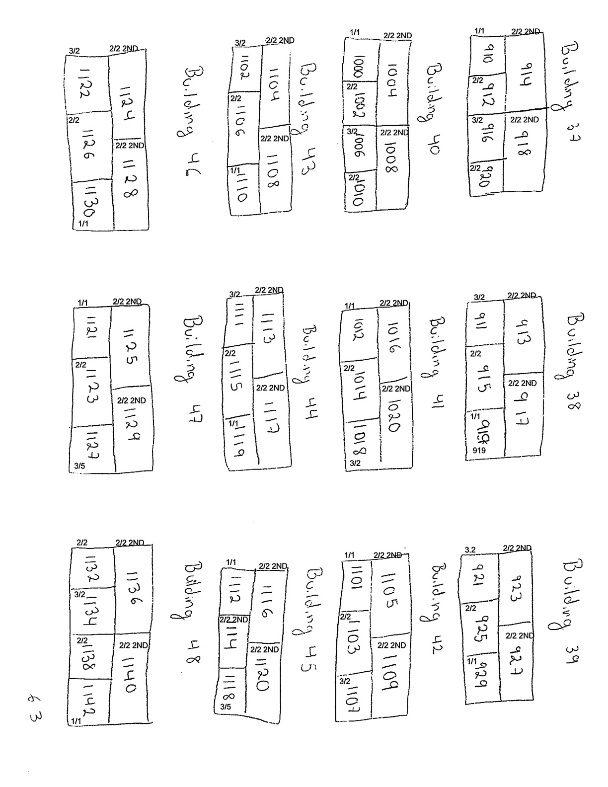
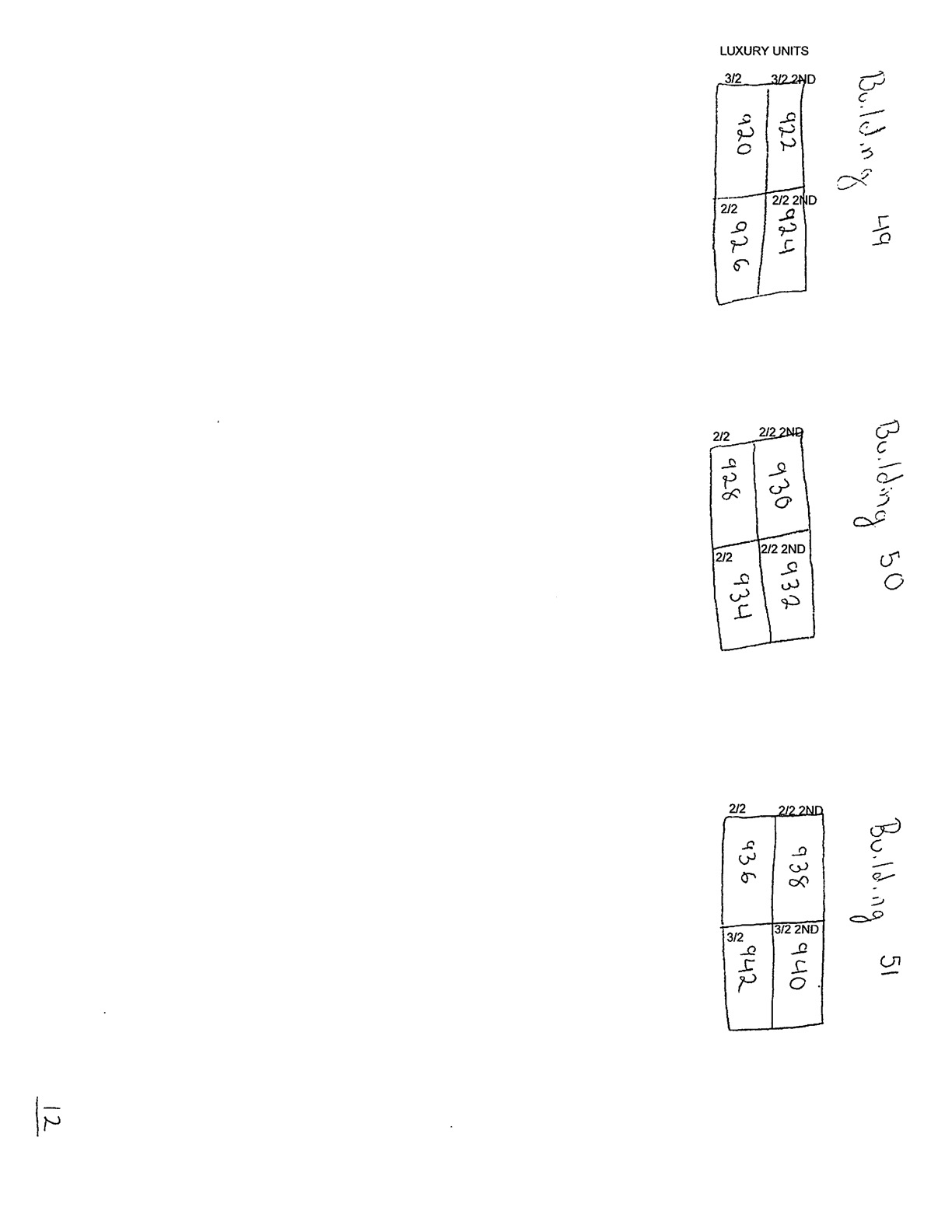
Designers work closely with client contacts and even on-site teams to arrive at the final Unit Map design. Engrain holds copyright on these final designs. This design is converted into our proprietary Unit Map data format and used in various forms within Engrain's own products as well as a wide ecosystem. These maps are used on ILS listings and around 50 other companies' products as a feature. The map may appear visually different depending on the application but the underlying Unit Map design is unquestionable.

We have spoken with 8 of our largest clients who represent 100s of the properties within the copied set of maps. These clients have confirmed they are not currently working with Beans, nor have they provided Beans with any of the source materials they provided to Engrain used to create the original Unit Map files.

805 Riverfront — A Clear Example

805 Riverfront St, West Sacramento, CA provides a clear, still-active example of Beans serving Engrain's copyrighted map data. The interactive maps below show Engrain's original data alongside the data Beans is currently serving.

This infringement is still active. As of this writing, Beans continues to serve map data for this property at 805riverfront.com. Beans has also corrected the transform errors we identified in our complaint for this specific property, though the timing of those corrections is unknown.

Static Rendering Comparison

Use the slider to compare the underlying map data between Engrain and Beans. Toggle between swipe and fade modes.

Engrain map data for 805 Riverfront Beans map data for 805 Riverfront

Interactive Map Comparison

Pan and zoom to compare the polygon shapes. Both maps are synchronized.

Engrain
Beans

Key Observations

  • Proprietary format, identical coordinates: Beans does not serve its data in standard GeoJSON. However, the geometry coordinates within their proprietary format use latitude/longitude pairs, which can be compared against. By converting both datasets to GeoJSON and rendering them as SVG, the similarity becomes unmistakable.
  • Near-identical polygon shapes: The unit boundaries in Beans' data closely mirror Engrain's copyrighted maps. The shapes, proportions, and spatial relationships are consistent with copying rather than independent creation.
  • Feature count disparity: Engrain's data contains 285 features; Beans' contains 299. The additional features do not explain the overwhelming similarity of the shared geometries.
  • Coordinate proximity: Both datasets center on identical GPS coordinates (Engrain: 38.5792, -121.5111; Beans: 38.5792, -121.5111), further demonstrating the data's common origin.
  • Transform errors corrected: The geometric transform errors that Engrain identified in the complaint have been corrected in Beans' data. While the timing of these corrections is unknown, the underlying data continues to be served.
  • Still actively served: This map remains live on the property website.

More Comparison Examples

The 805 Riverfront case study above is just one of thousands of instances we have identified. Below are additional properties where Beans is serving map data that closely or exactly mirrors Engrain's copyrighted designs. Select a property to compare.

Engrain map data Beans map data

Why This Matters

This lawsuit has significant implications not just for Engrain and Beans, but for the entire property technology industry and every company that invests in creating original spatial and map data.

Intellectual Property Protection

Property maps represent substantial creative and technical investment. This case establishes that copyrighted spatial data — polygon shapes, unit boundaries, and coordinate relationships — deserves the same protection as any other creative work.

Fair Competition

A healthy competitive market requires that companies invest in their own work. When a competitor can simply appropriate another company's data rather than creating their own, it distorts the market and penalizes companies that play by the rules.

Impact on Property Managers

Property managers and owners who use interactive map products should be aware of the provenance of their map data. If the data powering your property maps was obtained improperly, you may be unknowingly participating in the distribution of infringing content.

Precedent for Spatial Data

As GIS and spatial data become increasingly valuable across industries, this case helps establish important precedent for how copyrighted geospatial data is treated. The outcome will signal whether the industry takes intellectual property protection seriously.

Accountability Matters

Beans' dismissive response to these allegations sets a troubling precedent. If companies can appropriate others' intellectual property and simply dismiss the resulting legal claims, it creates a perverse incentive to copy first and deal with consequences later — or not at all.

Transparency & Trust

The property technology industry depends on trust between vendors, property managers, and residents. When that trust is violated through intellectual property theft, it harms the credibility of the entire ecosystem.